Bonus Chapter 4: Just Around The Riverbend
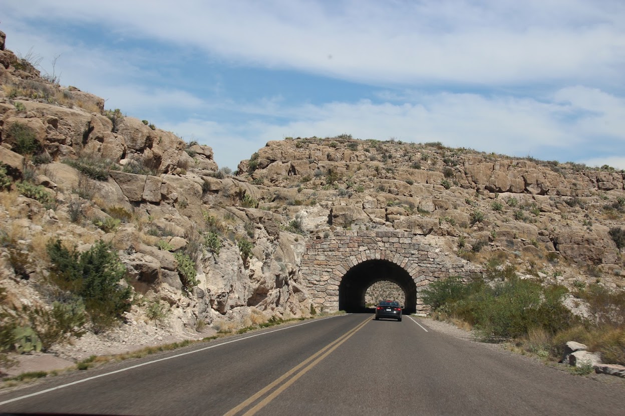
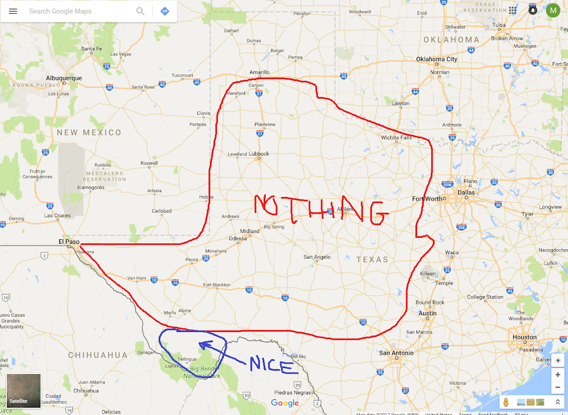
Several years ago, there was a tourism ad campaign for Texas in which the slogan was, “Texas: It’s Like A Whole Other Country.” I assume one of the rejected slogans was, “Texas: There’s A Whole Lot of Nothin’.” We had a 110-mile drive from Fort Davis State Park to Big Bend National Park where we drove through exactly three towns—Fort Davis at the start, Alpine in the middle, and Terlingua just outside the park gates at the end. Pro Tip: when driving around west Texas, keep a close eye on your fuel gauge.
We stopped in Alpine for gas. Our route through town caused us to jog to the east a bit. We took the main road through town, which was split into two roads—both one-way streets, separated by a city block. Julie and the kids needed to use the restroom, and we also needed to stock up on some snacks for the van. So she wandered down the street to a grocery store while I filled up with gas. I mean, er, I filled the van with gas. This wasn’t a Taco Bell.
Anyway, once I’d finished, I figured I’d drive to the store to pick up Julie and the kids and save time. Also, I’m a nice guy, not forcing them to walk back to me like that. So I started up the van and turned right to go down the street to the grocery store.
It took about a quarter-second after the turn before it hit me (metaphorically speaking, thankfully): I had just turned the wrong way down a one-way street.
Luckily, it was fairly early in the morning and traffic was light. So I calmly pulled over to the shoulder, waited for a break, and then made a U-turn to go around the block. A few people were staring at me from their front yard and I gave them a friendly, “Yep! I’m an idiot!” wave. I figured if anyone pulled me over I’d tell them I was a Canadian tourist named
@pkondz and I wasn’t used to these American roads.
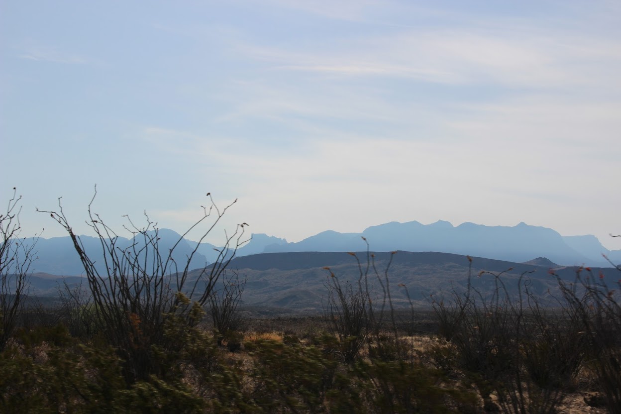
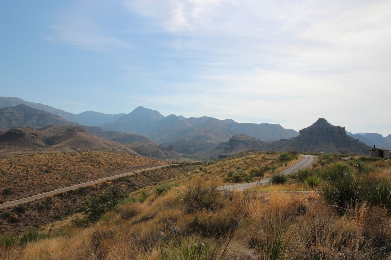
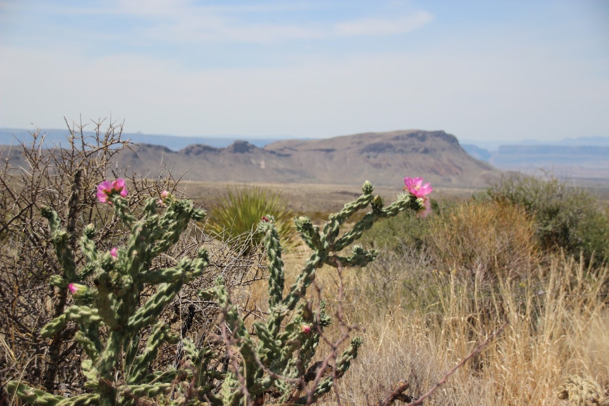
Serious accident averted, we got everyone back in the van and headed south. Although the drive is lonely and remote, it’s also very beautiful. You begin to encounter ridges and hills and eventually desert mountains that make the landscape much more interesting the further south you go.
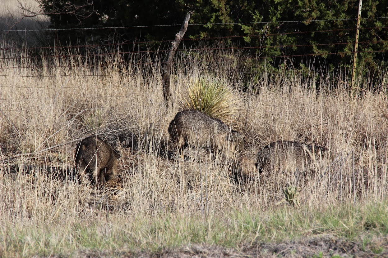
We also spotted a group of javelinas to the side of the road.
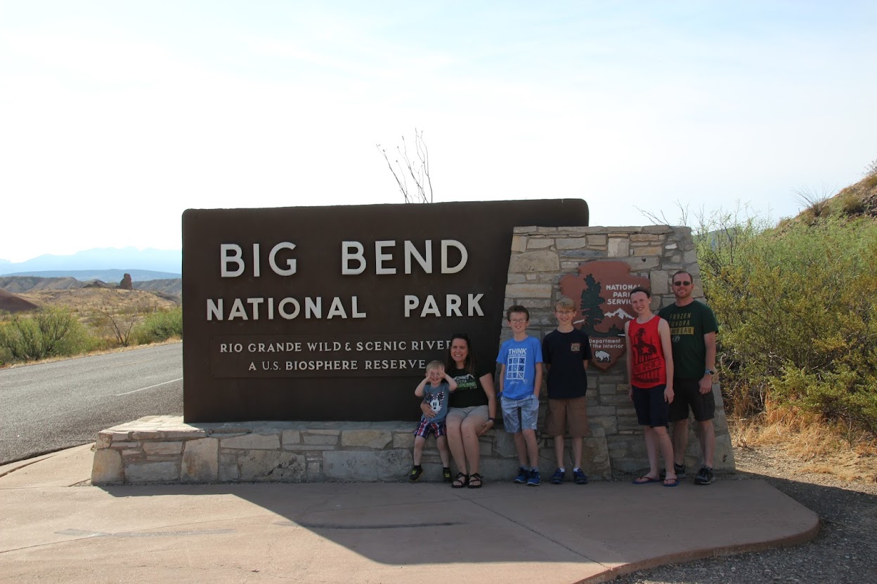
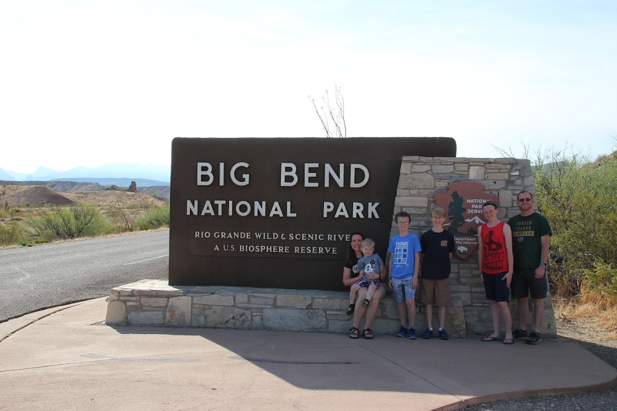
Eventually, we arrived at the outermost reaches of southwestern Texas, at the gates to
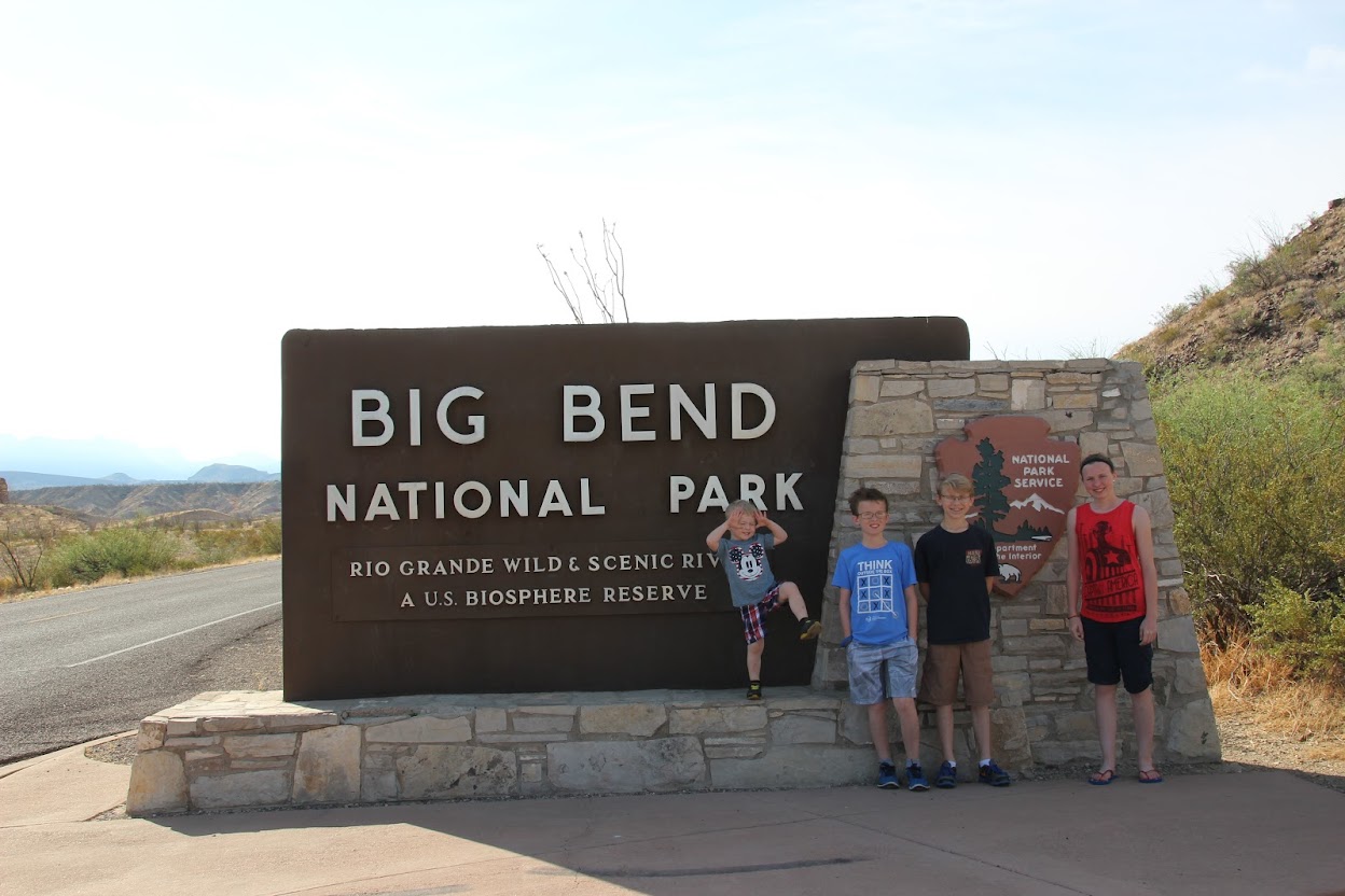
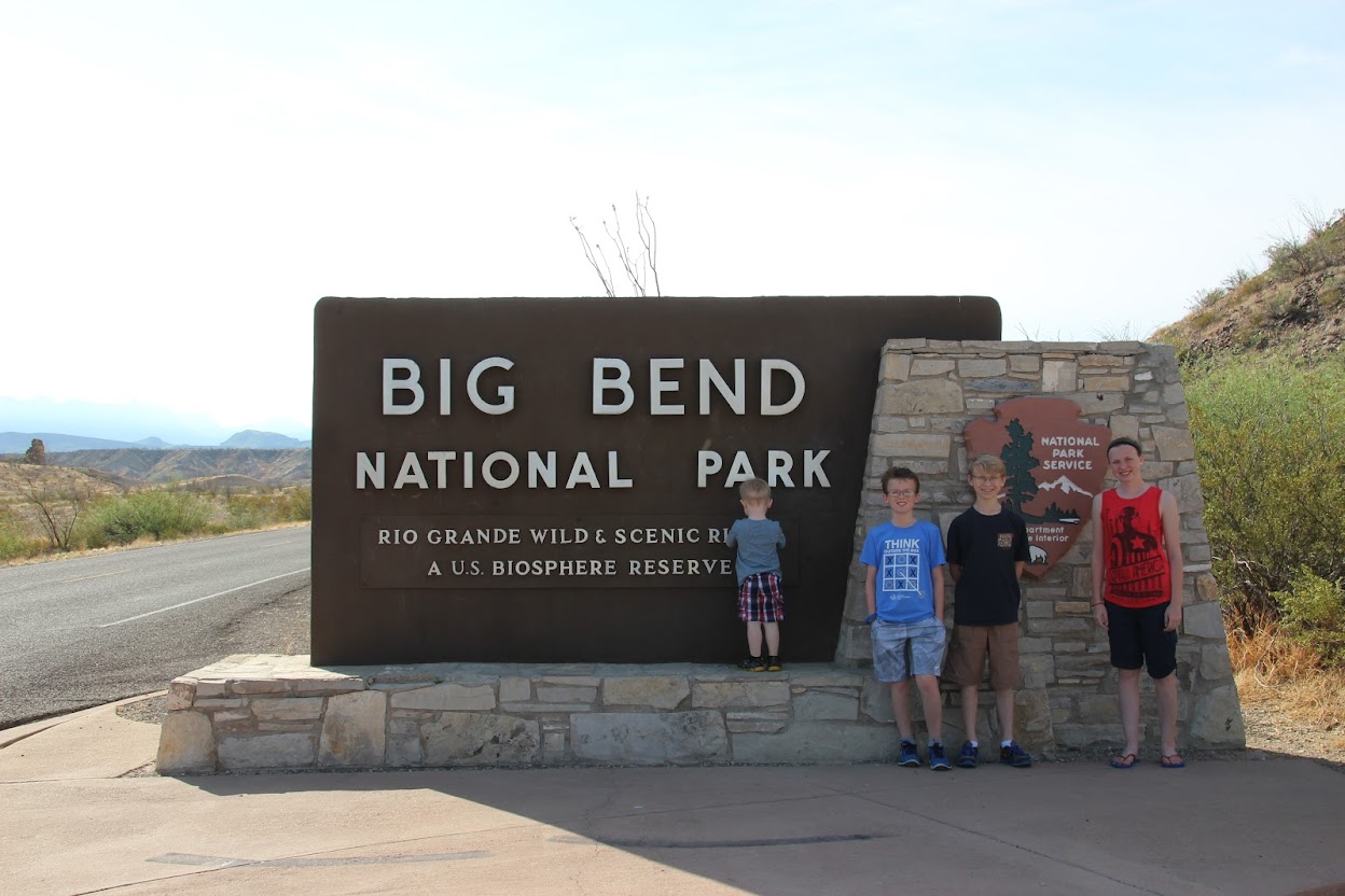
Big Bend National Park. We stopped here for our traditional beautifully composed photo of the kids looking like angels in front of the park sign.
Hang on, Drew’s dancing to showtunes or something. Let’s try that again.
There, that’s bet—sigh.
Maybe if Mommy and Daddy get in the photo it will help.
Oh, for pete’s sake. Julie, just hold his arms down, will ya?
Just trying to keep it real for you by pulling back the curtain and revealing all that goes on behind the scenes.
Big Bend National Park was founded in 1944 and comprises an area of 1,251 square miles, which is larger than the state of Rhode Island and ranks 15th in size among U.S. national parks. However, it still feels like one of the best-kept secrets of the national park system. It only averages about 350,000 visitors per year (Yosemite gets more than that in a month) and is seldom referenced, probably because its location is so remote.
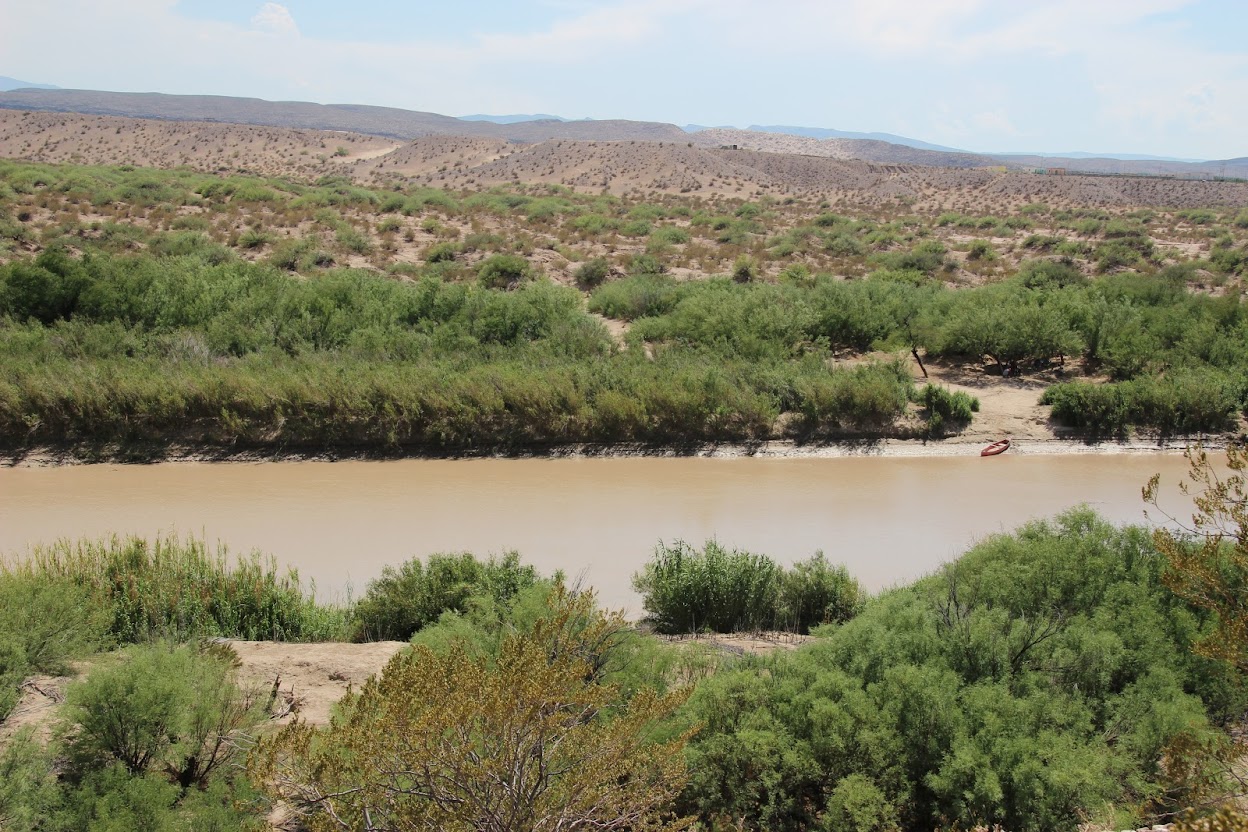
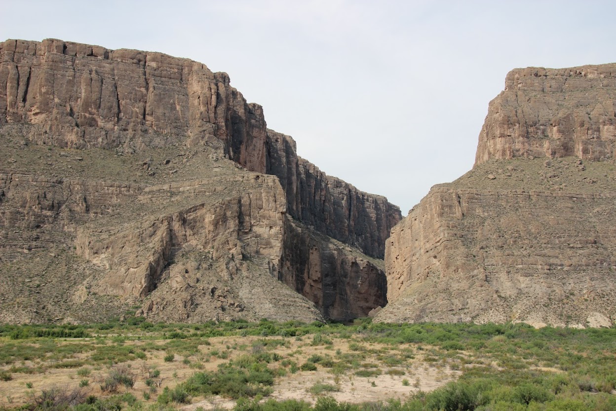
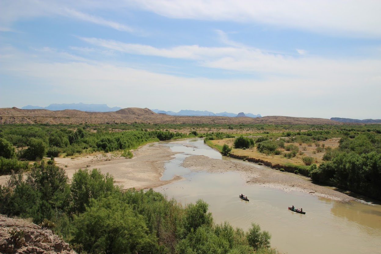
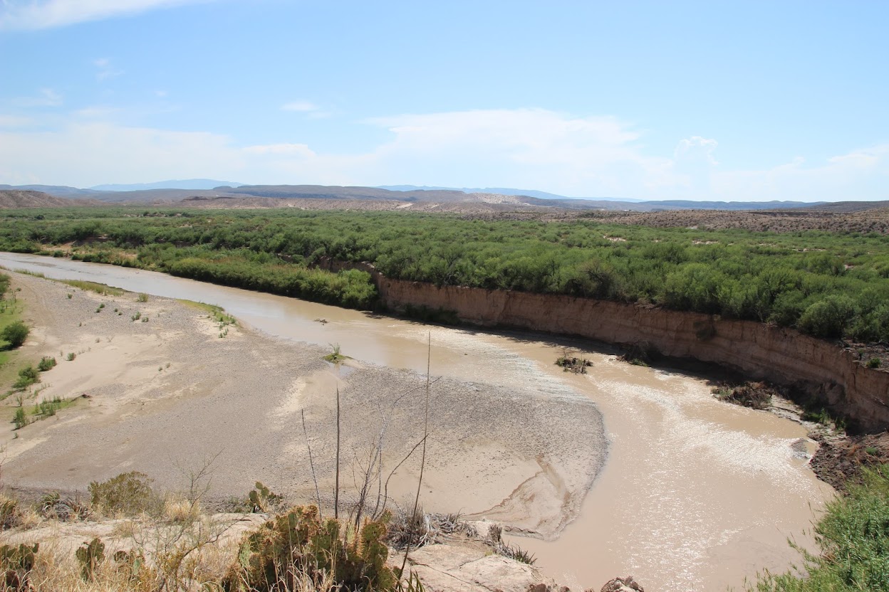
The park gets its name from a near-90 degree bend in the Rio Grande River, which forms the park’s southern border. The river, desert, and mountains combine to form a land of unforgettable desert scenery.
The Chisos Mountains form the centerpiece of the park. They’re tall enough to feature their own ecosystem, with trees and plants found in more temperate climates.
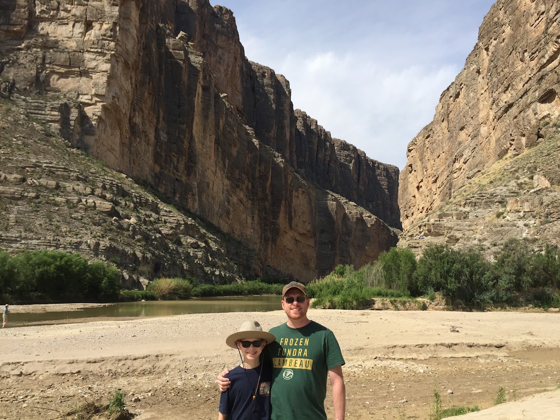
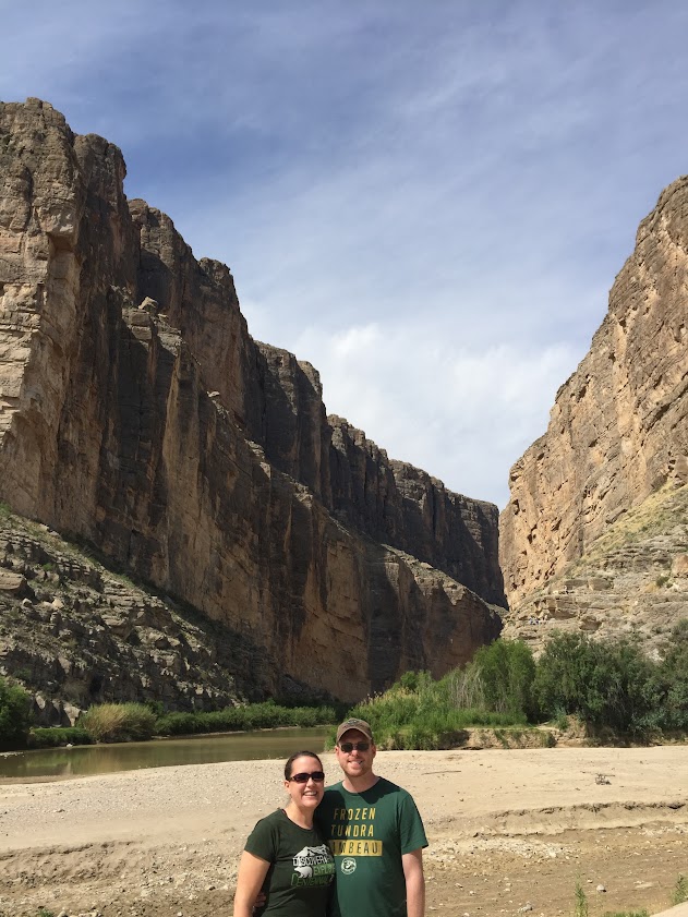
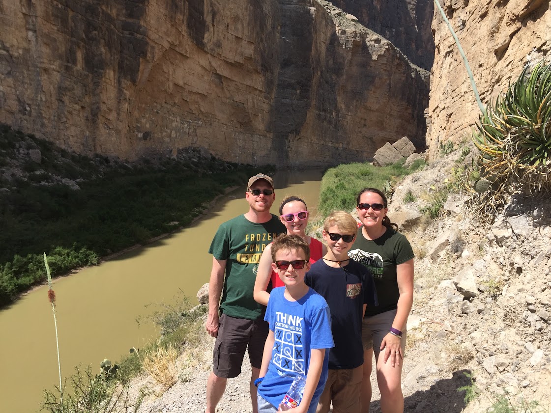
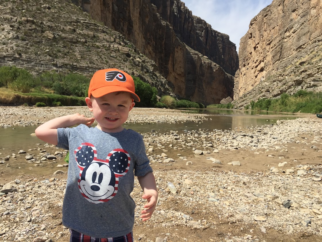
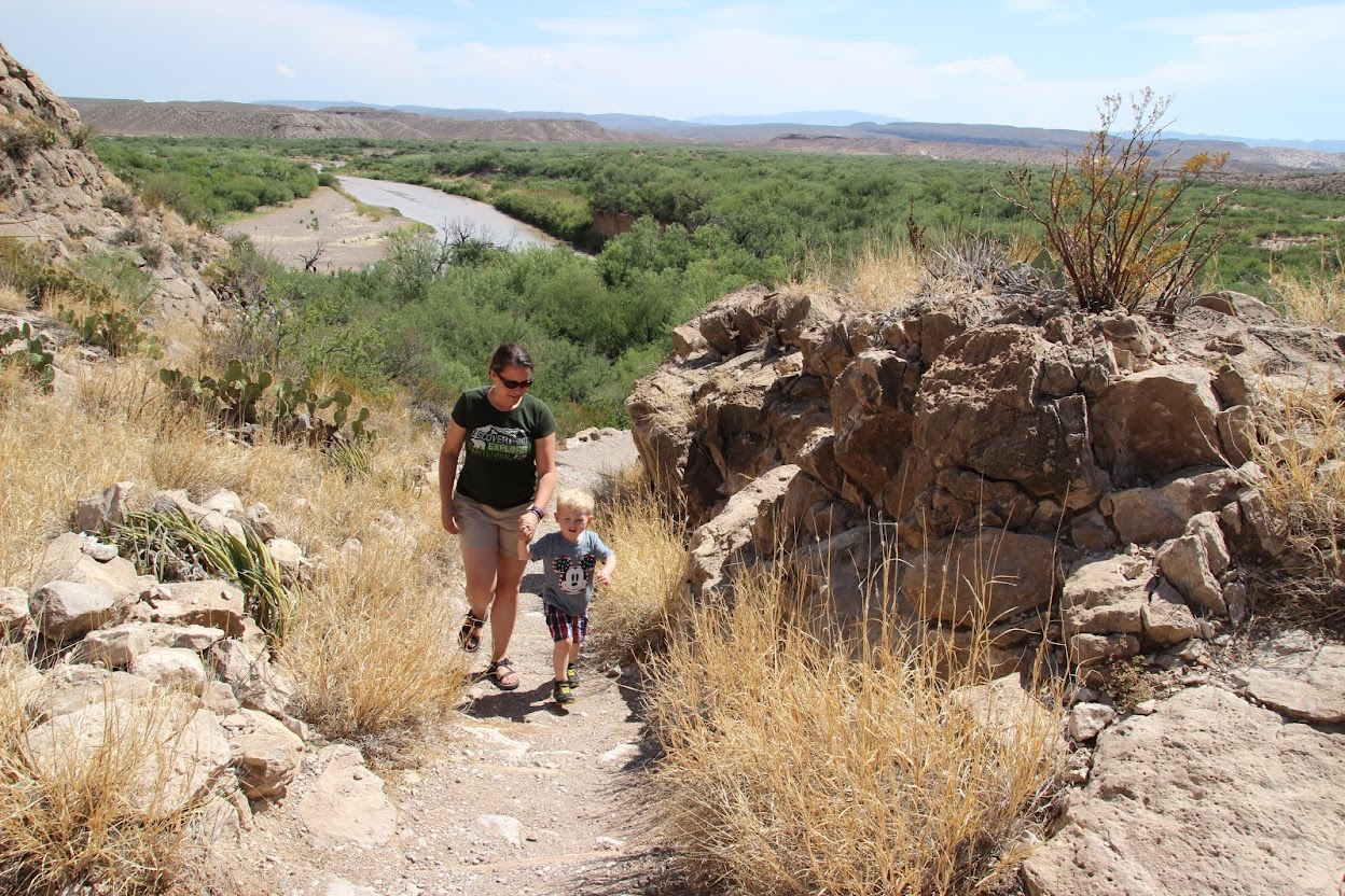
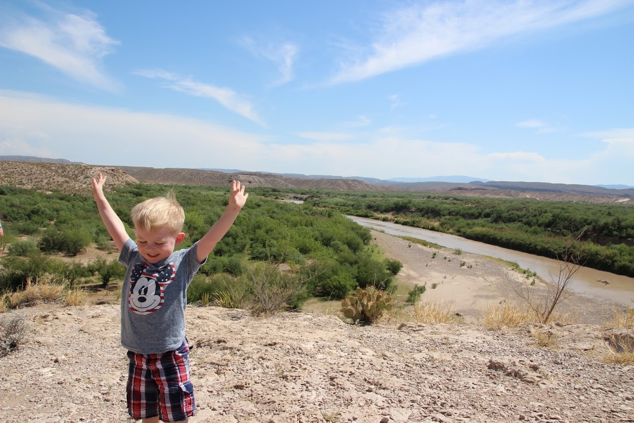
We headed first to the southwest corner of the park. It’s roughly 30 miles to the end of the road—a parking area at the trailhead for Santa Elena Canyon. This canyon is formed by the Rio Grande, the river which also serves as the border between the U.S. and Mexico. It’s a fairly spectacular formation that rises up suddenly out of the ground, with sheer vertical cliffs on each side of the river. In this photo, the U.S. side is on the right, with Mexico to the left.
This happened to be David’s birthday. He had wanted to travel to Texas for years, so it was extra special for him to be there on his special day.
I figured while we were there, I’d get a photo of me and the missus as well. It would make a good Facebook profile picture, don’t you think?
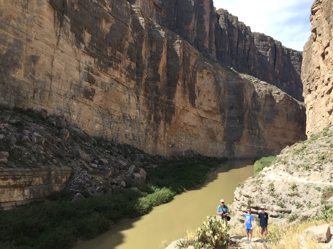
The hike is a great one because you can enter at the base of the canyon, rather than having to climb down from the rim. It’s not flat by any means—you have to do some climbing—but it’s a piece of cake compared to the work it would take to reach the bottom of the Grand Canyon.
EDITED to add one of the most important parts of the whole trip:
As we started the hike, we crossed a small dry riverbed (not the Rio Grande) and then climbed up a slope on the other side. The path led us through some scrub trees, and as usual the boys were blazing a trail/competing to see who could be first in line. My father, Sarah and I were next and Julie was somewhere behind us. She sometimes falls behind on hikes due to her duties as the chief photographer. The rest of us
get impatient tend to move ahead while she arranges her artsy-fartsy compositions.
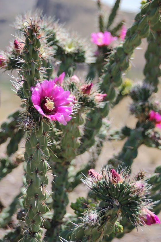
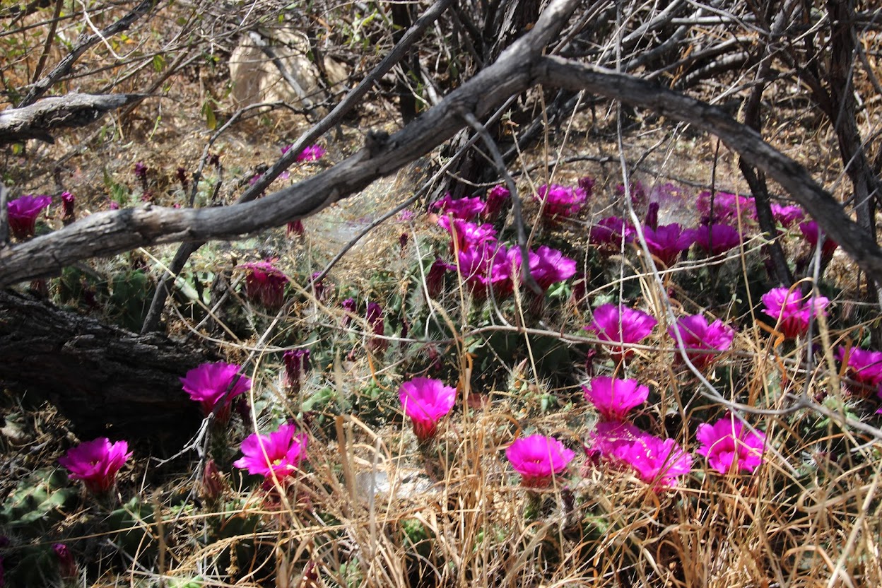
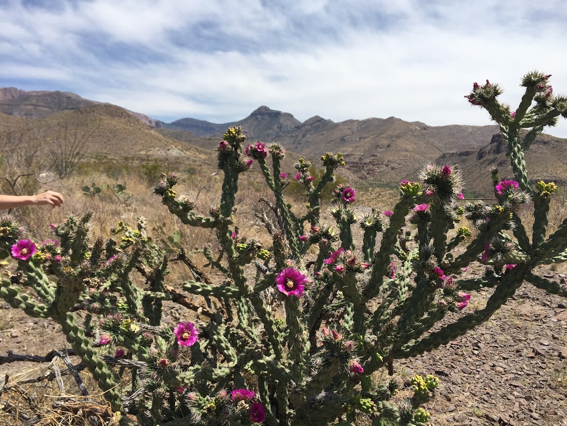
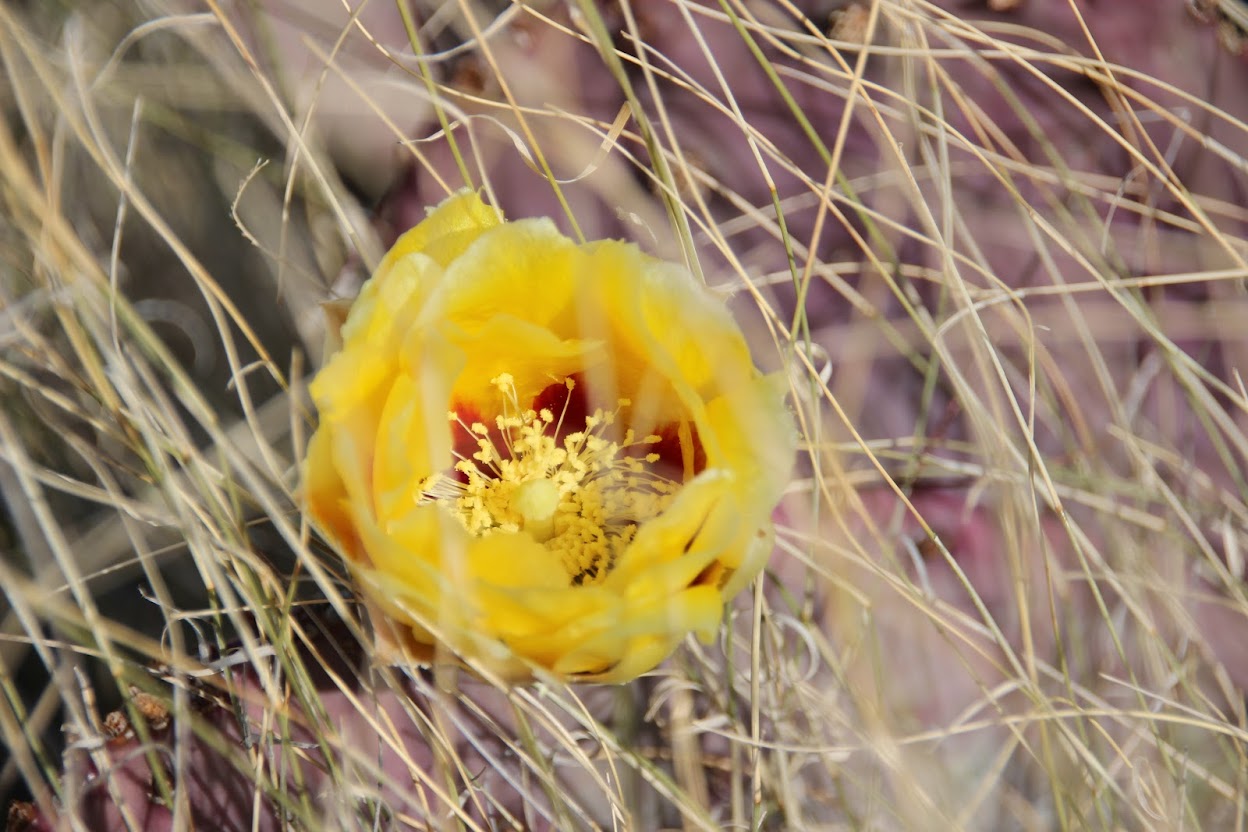
All this does is prove that we are jerks, because as you can see from the cactus bloom photos below, her artsy-fartsy compositions are well worth the time.
Anyway, we were moseying right along (because that's what you do in Texas) when suddenly, we heard a shriek. Next thing we knew, Julie came dashing up the trail right behind us. Suddenly on alert, we asked what was wrong.
"A snake just touched me!" she yelled.
Julie was wearing her sandals and walking up the trail behind us when she felt something brush her foot or ankle behind her. She looked behind her and saw a bright pink snake crossing the path. We learned later that it was a
Western Coachwhip--not poisonous, thank goodness.
Anyway, now you can say that Julie and Indiana Jones have something in common: a healthy dislike of snakes. Being a kind, sensitive family, we made sure not to bring this incident up at all for the rest of the week.
END EDIT
You can see that the water was very low in the river. It’s like this much of the year due to dams in the river much further upstream. All of the flow in the Rio Grande here actually comes from another river in Mexico, plus runoff from storms.
As we hiked into the canyon along the edge of the river, I was thinking of how close we were to another country. So, as any
9-year-old grown man would do, I started trying to throw a rock from the U.S. into Mexico. The first few splashed just short of the opposite edge, but eventually I landed one in a foreign country. Hey, we’ve got to start that wall somewhere, right?
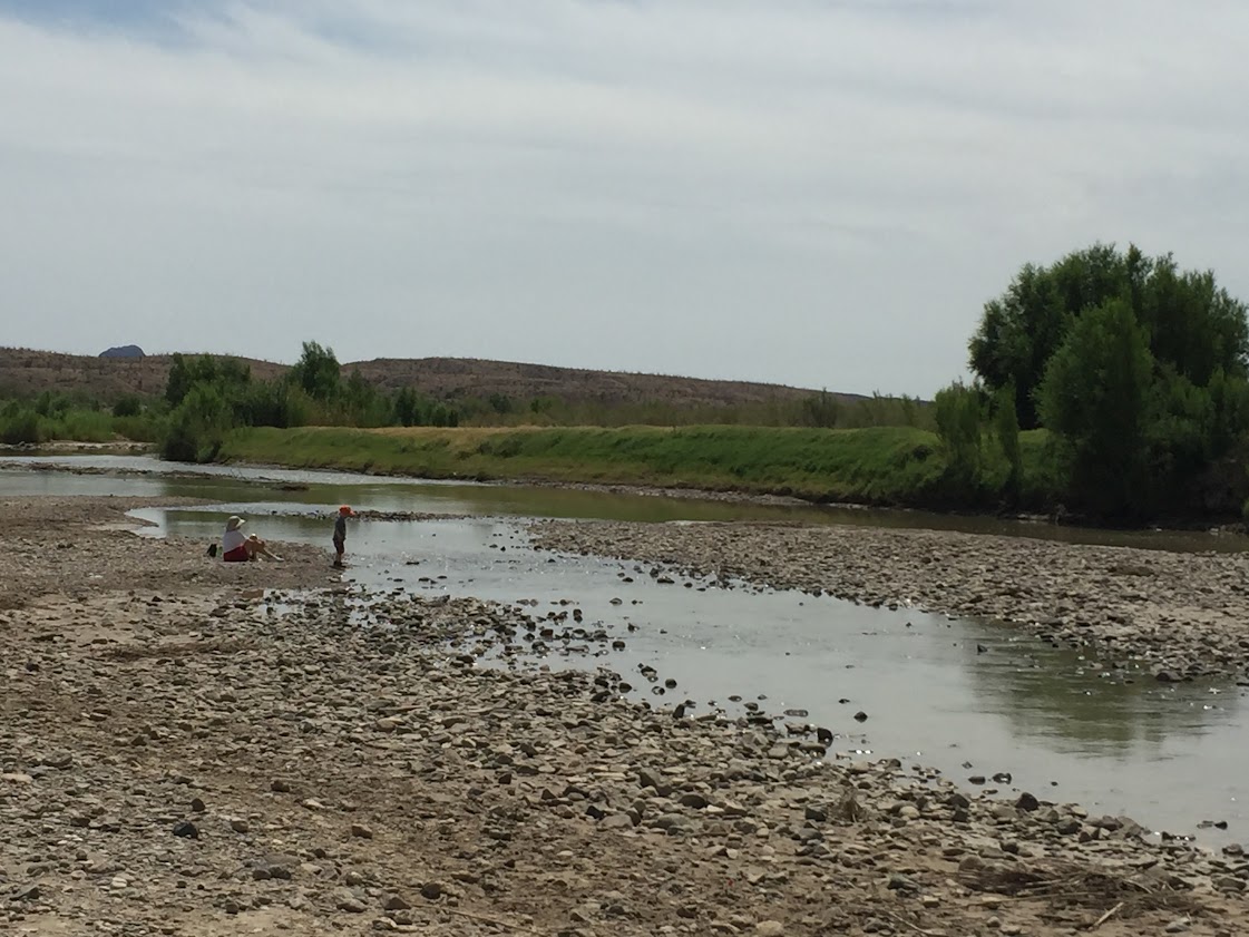
This is a terrific spot to hike—not terribly taxing and you can stand in a canyon staring up at the sheer walls. If you’re wondering where Drew was, he was with my Mom back at the trailhead, throwing his own rocks into the water. We figured he wasn’t up for that hike, and my mom has an injured foot that has been slow to heal, so she stayed to play with her grandson.
He seemed ok with that.
We stopped for PB&J sandwiches at the Castolon visitor center. Then we drove back on the main road to the eastern portion of the park, stopping at the main visitor center on the way for the usual park movie/junior ranger activities/souvenir shopping. Along the way, we got more of an idea of why my parents keep returning here every so often during the spring. On the drive in, we’d noted that many of the cactus plants along the road had numerous buds on the leaves. As the sun shone and the day warmed up, the buds opened and suddenly there were cactus blooms everywhere.
These photos are mostly of pink cholla cactus blooms, but yellow pricklypear blooms were the dominant feature of the park.
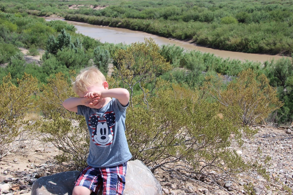
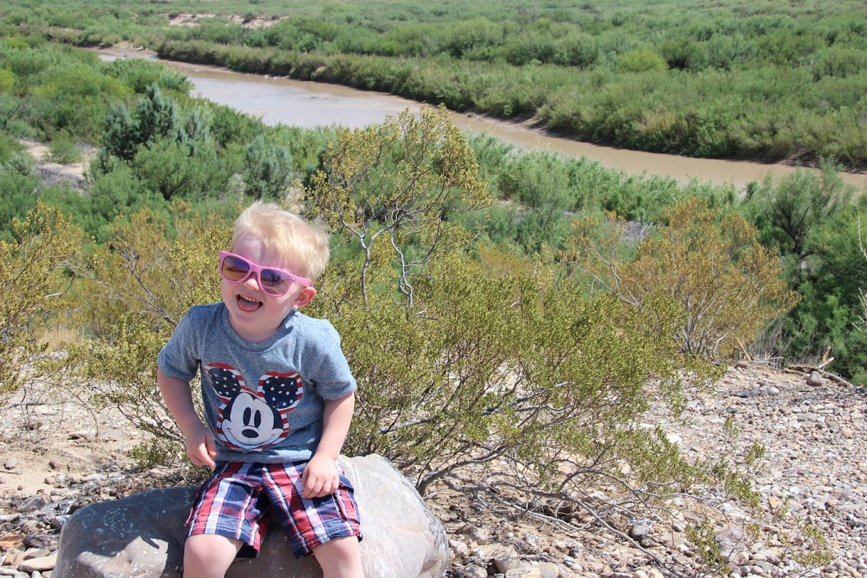
The eastern part of Big Bend is flatter. The road also descends to the Rio Grande on that side of the park, ending again at a trailhead that leads you to a canyon—Boquillas Canyon. We didn’t have time to do the full hike here, so we just did a piece of it. And Drew came along for this one.
You can see a boat across the river in Mexico in this photo. There’s a border crossing nearby and the Mexican town of Boquillas del Carmen lies across the river. It’s a poor, isolated town—over 100 miles to the nearest town (and paved roads) in Mexico. It largely depended on tourism and easy border crossings to Texas, but that changed with the September 11 attacks. Now the border is only open a few days a week.
Residents looking to make a living have gotten creative. We noticed a couple of spots on the trail where little pieces of jewelry and figurines had been left on the trail next to a cup with money in it. A sign labeled everything as $5 apiece. The residents sneak across the river in the boat, leave their wares on the hiking trail, and then float back to the other side of the border. They depend on tourists using the honor system for payment. Then they come back at night to collect their earnings. Not everyone in town depends on this for a living, of course. There are a couple of restaurants, etc. in the town. I just thought it was interesting to see how people try and eke out a living in such a remote place.
Drew thought he was hot stuff, going along for his first real family hike. And he was, especially in such bright sun.
Thankfully, his big sister’s sunglasses helped.
He walked the whole way to an overlook. I didn’t get a good picture, because we couldn’t really see into the canyon from there. Unfortunately, we didn’t have time to go that far. Being mid-to-late afternoon, it was also the hottest part of the day and temperatures were well into the 90’s at this point. For you Canadians, that's like 2000 Celsius or something.
But Drew stuck with us the whole way and never had to be carried once! He conquered the trail!
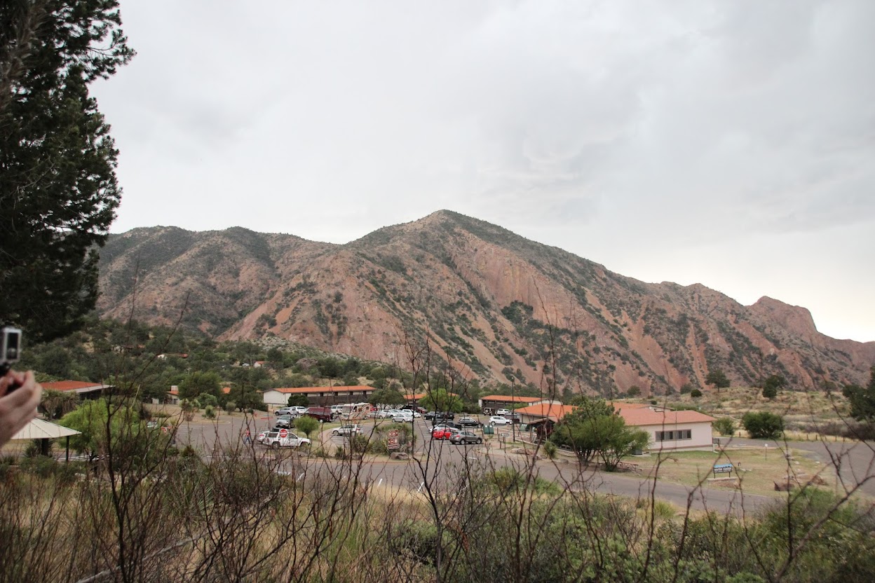
We’d seen the canyons, desert and river. Now it was time to check out the mountains. We’d cut our time on the trail short because my dad wanted us to go up into the Chisos Mountains and see that part of the park. There was another trail he was hoping to take us on that would afford a nice view of the mountains and valley to the south. The skies were starting to get dark, though, so we decided to get dinner first before venturing out in the hopes that it would clear. And between you and me, if given the choice of walking in desert heat or eating, I'm generally going to choose the food.
We drove up into the mountains to the Chisos Mountain basin. It was about a 7-mile drive into a small valley surrounded by rock walls. Our photos don’t really do it justice, because it was much more green and lush there—a sharp contrast to the desert surrounding the mountain range. They even have bears that live in the woods up there. Yet another reason to go for the dining hall instead of the trail.
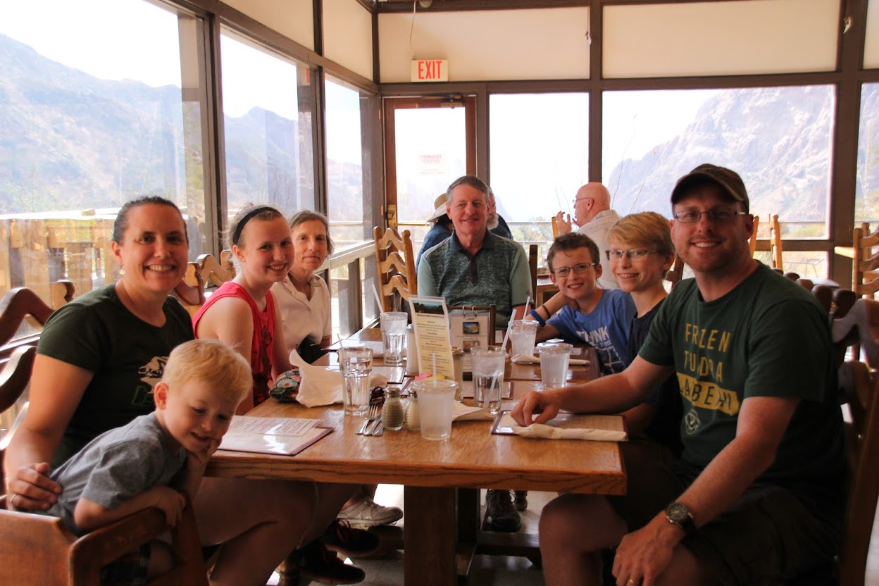
We went to the restaurant inside the
Chisos Mountains Lodge for dinner, mostly out of a lack of other options. But we actually ended up being pleasantly surprised. The food was pretty good.
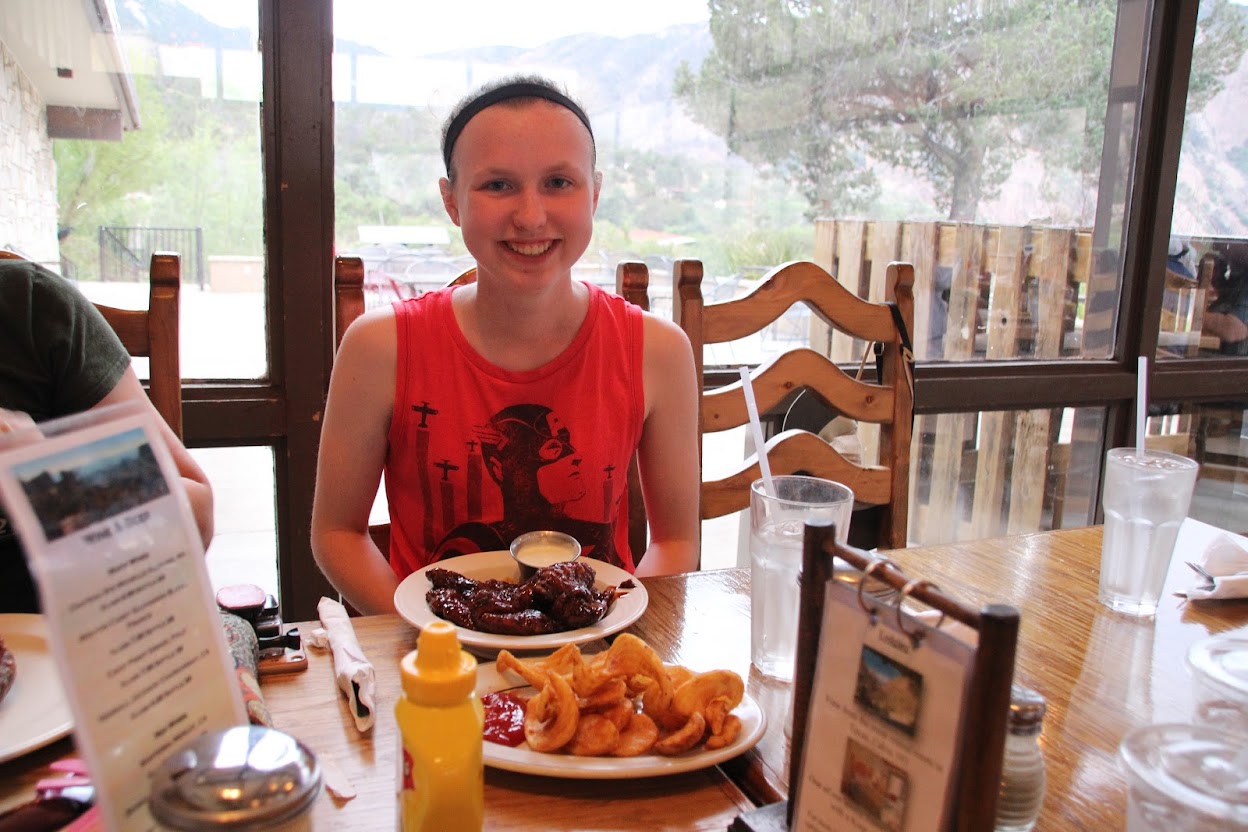
This was Dave’s 13th birthday, which meant we now had two teenagers plus a toddler living under our roof. Please pray for us. Anyway, as befitting teenagers, they mostly ordered greasy appetizers. I can’t remember what everybody got so I can only go by photo evidence. Sarah loaded up on wings and fries.
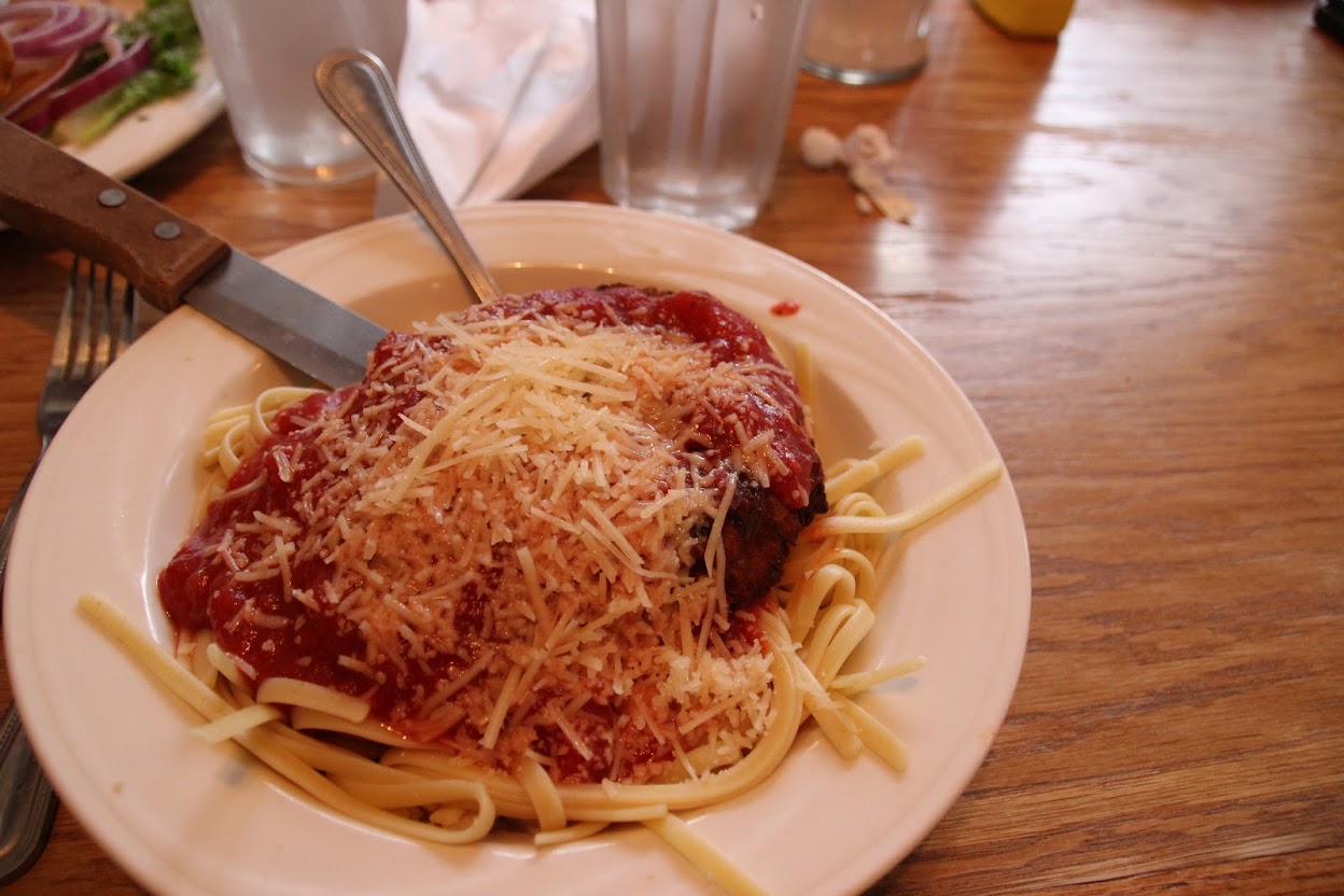
And I got chicken parm, and I liked it, so you know I have to say it: Chicken parm, you taste so good. You're welcome for the earworm.
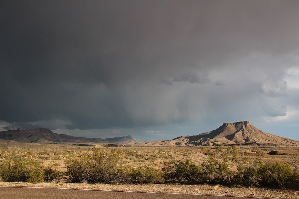
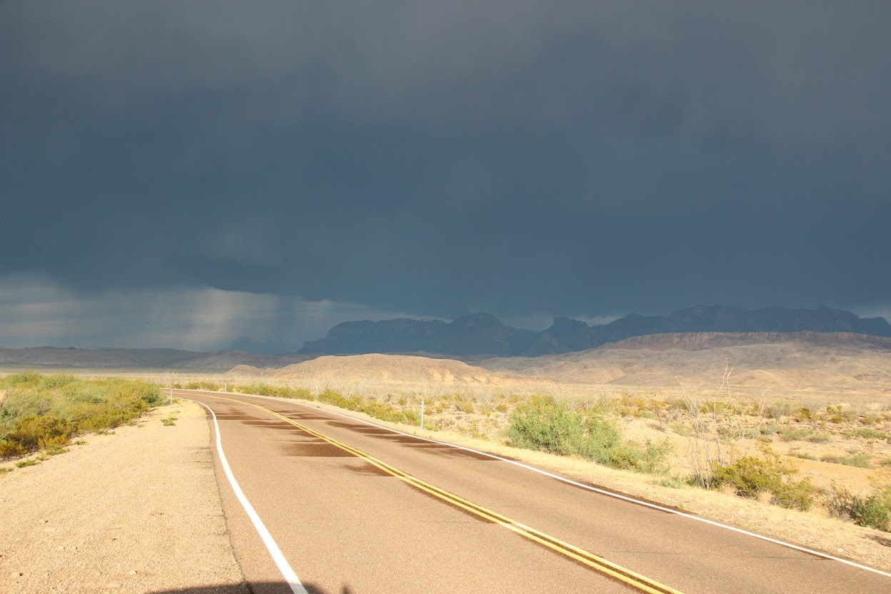
We finished dinner, and the skies still looked threatening. Soon after, it finally started to rain, and we had to bag the hike. So, now we have a reason to go back.
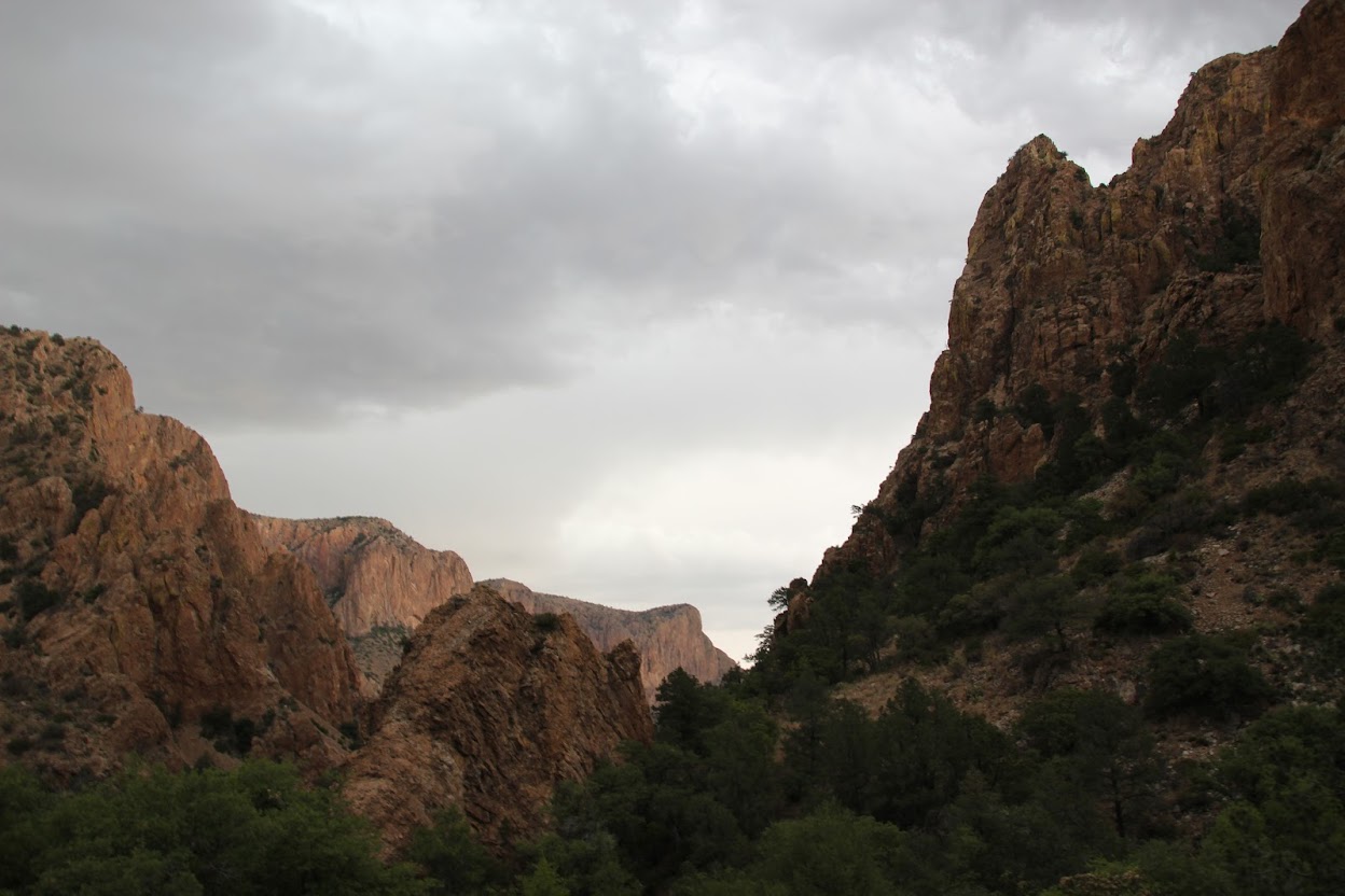
We drove back down out of the mountains and headed west out of the park. As we looked back, we realized it was a wise decision not to try and walk the trail.
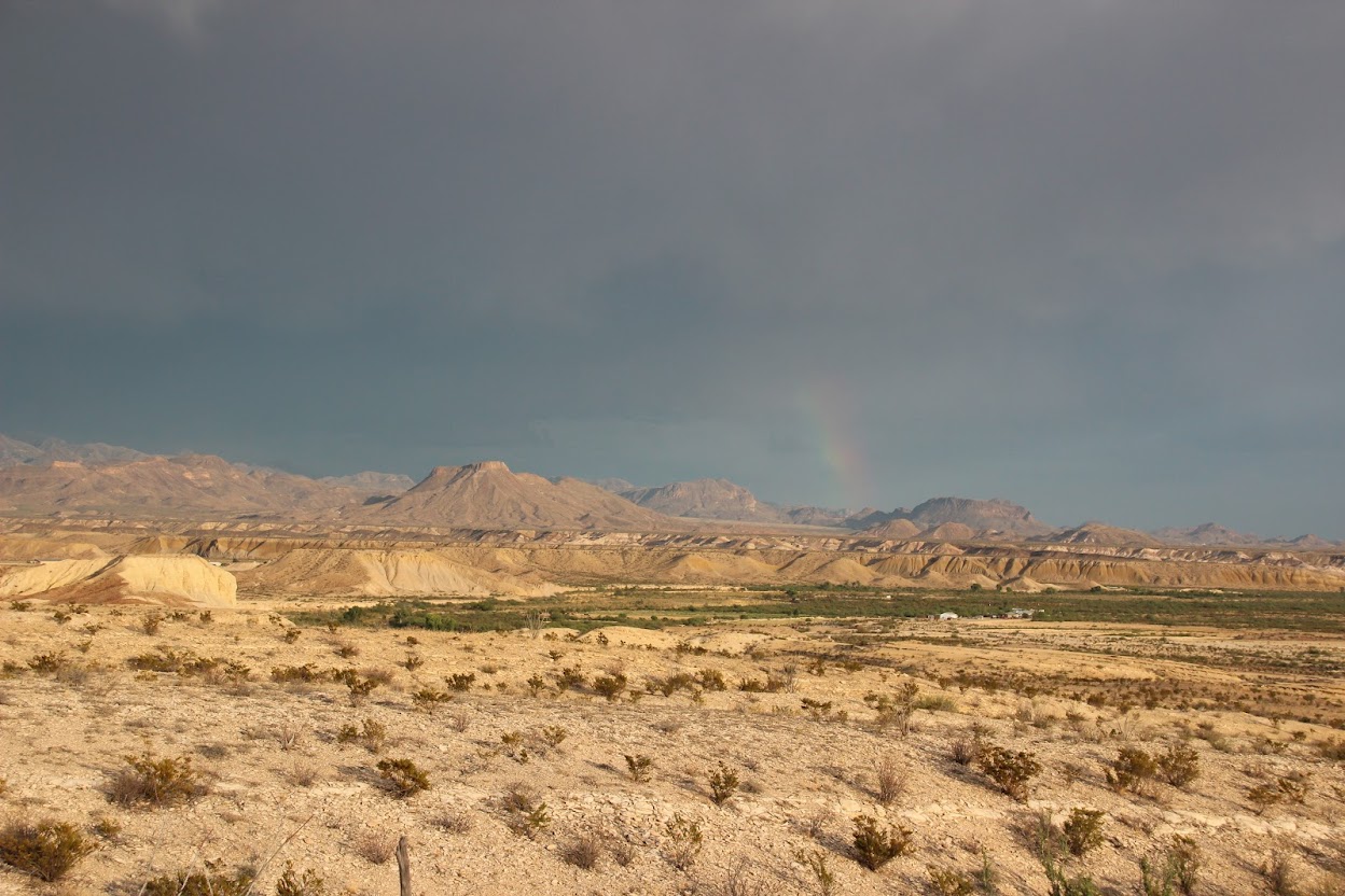
With such a big storm behind us and bright sunlight ahead of us, we were on the lookout for rainbows in the area. And eventually, we were rewarded!
Sort of. We got the world’s faintest, shortest, crappiest rainbow. Can you see it?
It doesn’t matter. I don’t know if the photos in this chapter will convince you, but we really fell in love with Big Bend. The scenery and diversity of the park, along with the cactus blooms, made it a real highlight of the trip. It’s in the middle of nowhere, but it’s worth the effort to get there.
Speaking of being in the middle of nowhere…where in the heck are we supposed to spend the night?
Coming Up Next: No, really. It’s not like they have Holiday Inns around here.

")


 Persistence.
")


 I guess the important thing is that you looked cool. You weren't cool, but you looked it.


